Skip to content

Well geophysics and well logging

DMT’s borehole geophysics: Precise borehole measurements for geothermal energy, mineral exploration, geotechnical engineering, hydrogeology, tunnelling and integrity checks. State-of-the-art borehole probes for safe and reliable subsurface investigations.

Well logging provides information about the properties of the subsurface directly within the borehole.

It forms the basis for decision-making in the fields of geothermal energy, energy, raw material extraction, infrastructure and the environment. With a broad portfolio of modern borehole logging systems, DMT covers applications ranging from small-diameter water well drilling to geothermal and exploration drilling at depths of several kilometres.

Our geophysical well logging services enable the characterisation of rocks, geological structures, aquifers and well casings. In both open-hole and cased boreholes, all standard measurement methods are available to determine formation properties and monitor borehole integrity.

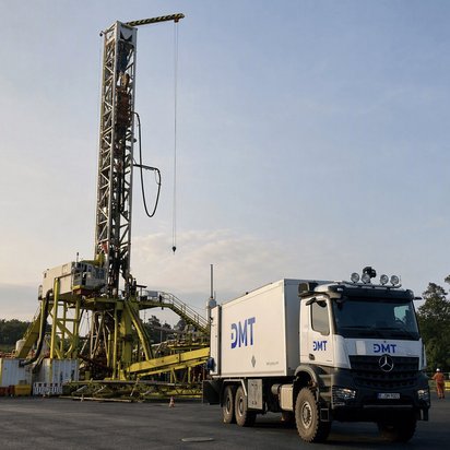
In addition to standard probes, high-pressure/high-temperature (HPHT) probes and slimhole probes are used. Measurements can be taken either from a lorry, a van or without any measurement vehicle at all.

“With well logging, you can see what the subsurface would rather keep hidden – without needing a crystal ball!”


Christian Kämmer
Well Logging

+49 201 172 1284

Open Hole | Measurements in uncased boreholes

In uncased boreholes, we measure the physical properties of the rock in the vicinity of the borehole. The measurements provide information on lithology, porosity, density, fractures and fault zones, as well as on the borehole’s trajectory.

  • Natural gamma radiation
  • Spectral gamma radiation
  • Rock density
  • Acoustic travel times (Fullwave Sonic)
  • Electrical resistance
  • Calibre, borehole volume
  • Temperature and conductivity of the borehole fluid
  • Borehole trajectory and orientation
  • Imaging techniques (acoustic, optical and electrical imaging of the borehole wall)
  • Further methods available on request

Cased Hole | Measurements in cased boreholes

In cased boreholes, we record the casing configuration and the borehole fluid: cementation, wall thickness and internal diameter of the casing, the position of the couplings, as well as temperature, conductivity and inflows.

  • Cement bonding (CBL, SBT)
  • Pipe wall thickness
  • Multi-finger gauge
  • Sleeve localisation
  • Borehole camera
  • Temperature and conductivity
  • Flow measurement
  • Fluid sampling
  • Gyroscopic trend analysis

Extensive borehole techniques

These techniques look beyond the borehole wall. They survey the rock formation around a borehole or between several boreholes, revealing voids, faults and changes in rock type even at greater distances.

  • Vertical Seismic Profile (VSP)
  • Borehole tomography
  • 3D borehole radar

Our open-hole and cased-hole services support projects in the following areas:

Reliable subsurface data is crucial for the commercial utilisation of geothermal energy, as well as for the exploration and production of hydrocarbon reservoirs. Geophysical well logging provides detailed information on lithology, porosity, temperature distribution, fractures and fault zones.

The data obtained supports reservoir characterisation and enables an assessment of geological potential. This helps to reduce risks, optimise drilling programmes and improve the efficient use of natural resources.

Geotechnical borehole measurements focus on assessing the nature of the ground and the stability of the subsoil for construction projects. This includes measurements of the elastic properties of rock, from which strength parameters can be derived, as well as the identification of stratigraphic boundaries and faults. Acoustic methods are used to detect cracks, fissures and voids that may affect structural stability. The results of these measurements are used in the planning, safety assurance and monitoring of structures such as tunnels, bridges or foundations, and help to minimise risks.

Well logging surveys significantly enhance the informative value of hydrogeological boreholes. They assist in identifying aquifers and impermeable layers and provide valuable information on the distribution of groundwater in the subsurface.

In addition, specialised measurement techniques and sampling methods enable the assessment of groundwater quality. Contamination, mineralisation and hydrochemical characteristics can be identified at an early stage and taken into account in further planning.

For demanding applications in mining and tunnelling, DMT employs specialised techniques such as borehole scanners, borehole cameras, 3D borehole radar and borehole tomography. These can also be used in horizontal or inclined boreholes.

These technologies enable high-resolution investigation of geological structures such as stratigraphic boundaries, voids, karst features, zones of weakness or areas of loosened rock. The results support the planning and execution of tunnelling and mining projects, as well as risk assessment prior to the launch of tunnel boring machines.

The inspection of casing, cementation, filter sections, socket joints and backfill is an essential part of well monitoring. Geophysical integrity surveys ensure the reliable inspection and assessment of the condition of wells. Precise measurement techniques assess the quality of cementation, detect signs of leaks and seepage, and identify corrosion and damage to the casing. This protects facilities, minimises environmental risks and extends the service life of wells.

Regular monitoring measurements enable the early detection of:

  • corrosion damage
  • Leaks
  • Changes in the backfill
  • Scouring
  • Iron deposits
  • Material wear

This provides a basis for maintenance measures and contributes to the long-term safety, cost-effectiveness and availability of boreholes.

Please contact our team of experts in well logging.


Please get in touch with us; together we’ll find the best approach for your project. We look forward to hearing from you!

What you should know

Frequently Asked Questions on Well Logging

Downhole geophysics involves geophysical measurements taken directly within the borehole to determine the properties of the subsurface, geological structures and the technical condition of boreholes.

Well logging provides information on lithology, porosity, temperature, rock density, electrical properties, fractures, fault zones and the condition of casing and cementation.

In geothermal projects, well logging helps to assess reservoirs, determine temperature distribution and optimise drilling and production strategies.

Integrity assessments are carried out using specialised wellbore probes, which analyse the condition of the casing, cement, filter sections and backfill, and detect any potential damage at an early stage.

It enables the investigation of cavities, zones of weakness, karst structures and geological faults prior to construction and tunnelling works, thereby helping to minimise risks and ensure planning reliability.