Specialised surveying and control surveying with the highest precision
Request a Consultation on Special Surveying Services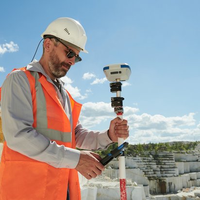
Specialised surveying provides highly accurate geodata for demanding infrastructure projects, tunnel construction schemes and mining operations. It forms the basis for safe construction and operational processes, reliable project management and the precise execution of complex engineering works.
DMT carries out specialised and control surveying worldwide, combining many years of experience with state-of-the-art surveying technology. Our experts develop bespoke surveying concepts and utilise innovative systems for high-precision position, control and deformation measurements.
Please get in touch with us to discuss your surveying requirements. Together, we will develop efficient and project-specific solutions for your project.
In tunnel construction and pipe jacking, precise surveying data is crucial for quality, safety and cost-effectiveness. Even the slightest deviations can have a significant impact on construction processes, tunnelling progress and breakthrough accuracy.
DMT carries out high-precision 3D network surveys and supplements these with independent gyro control surveys. The tried-and-tested precision systems DMT Gyromat 2000, DMT Gyromat 3000 and DMT Gyromat 5000 are used for this purpose.
With more than 50 Leica GNSS systems and ten specialised gyro measurement systems, DMT has state-of-the-art surveying technologies at its disposal for national and international projects. Regular calibration and maintenance ensure consistently high measurement quality and reliable results.
In the mining sector, DMT supports operators with complex surveying tasks both underground and above ground. The geodata obtained forms the basis for safe operational procedures, long-term planning, transparency and sustainable monitoring.
Services in the mining sector
DMT uses kinematic shaft surveying systems to document shafts. These enable highly accurate geometric and photorealistic mapping of the infrastructure. Inaccessible cavities are surveyed and digitally documented using specialised borehole scanners.
Specialised surveying involves high-precision surveying methods for projects with specific accuracy requirements, such as in tunnel construction, mining or complex infrastructure projects.
Verification surveys check the accuracy of existing survey networks and construction work. They help to identify deviations at an early stage and ensure the long-term quality of a project.
GNSS enables precise positioning via satellite systems and supports the densification and monitoring of geodetic networks, even over long distances.
To this end, DMT uses kinematic shaft surveying systems and specialised borehole scanners. These technologies enable highly accurate geometric and photorealistic data capture, even in areas that are difficult to access.