3D Surveying & BIM
Digital precision for construction and infrastructure
Request advice on 3D surveying and BIM
Digital precision for construction and infrastructure
Request advice on 3D surveying and BIM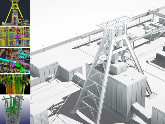
DMT GROUP produces high-precision digital as-built surveys for the planning, construction, operation and maintenance of buildings, industrial facilities, transport routes and complex infrastructure. Using technologies such as the Global Navigation Satellite System, terrestrial surveying and 3D laser scanning, we capture as-built data comprehensively, quickly and with millimetre precision. As a partner across the entire value chain, we integrate surveying, data management, modelling and analysis into a seamless process.
Building Information Modelling (BIM) complements this data foundation with a digital, model-based working methodology. Relevant building data is captured in an interdisciplinary manner, linked and utilised throughout the entire life cycle. BIM, along with CAD and GIS technologies, forms a central component of our digital project strategy. We create, coordinate and verify BIM models in a standardised and quality-assured manner. This enables us to identify risks and opportunities for optimisation at an early stage, reduce planning errors and minimise construction times and cost overruns.

Dr Karsten Zimmermann
Head of Monitoring & Data Engineering
+49 201 172 1968
3D surveying captures buildings, terrain and infrastructure as precise digital as-built models. Depending on the task at hand, techniques such as 3D laser scanning, terrestrial surveying, GNSS or drone-based data collection are used. The data provides a reliable basis for planning, construction, operation and maintenance.
Building Information Modelling, or BIM for short, is a digital, model-based methodology for the design, construction and management of buildings and infrastructure. Geometries, technical properties, schedules and other relevant information are brought together in a structured manner within a single model and utilised across disciplines.
3D surveying provides precise data on the actual existing conditions. BIM organises, links and utilises this data to facilitate collaboration across disciplines and project phases. Together, these two methods create a robust foundation for as-built documentation, design, construction and operation.
3D laser scanning is particularly well suited to complex, hard-to-access or large-scale existing structures, such as industrial plants, transport infrastructure, civil engineering structures and buildings. The technology enables rapid, comprehensive data capture and supports the creation of digital as-built models.