Industrial Surveying
Precise surveying for industrial plants and technical infrastructure
Request a consultation on industrial measurement now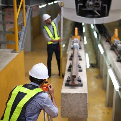
Precise surveying for industrial plants and technical infrastructure
Request a consultation on industrial measurement nowIndustrial surveying lays the foundations for safe construction and assembly processes, efficient operational procedures and sound decision-making in plant management. We carry out precise surveys of industrial plants, energy infrastructure and engineering structures, and provide the resulting geodata for planning, construction, operation and maintenance.
Using state-of-the-art surveying technology, many years of engineering expertise and digital workflows, we support companies in plant engineering, energy supply and the infrastructure sector in the implementation of complex projects. We integrate the collected data seamlessly into CAD, GIS and Building Information Modelling (BIM) processes, thereby creating a reliable foundation for digital twins and data-driven decisions.
Industrial surveying encompasses the precise measurement, inspection and documentation of industrial plants, technical structures and infrastructure projects throughout their entire life cycle.
Precise measurement data is of paramount importance in plant engineering and during assembly. It enables components to be installed with precise positioning, allows technical specifications to be verified, and ensures that defined tolerances are adhered to.
We support construction and assembly processes with high-performance surveying technology, document deviations between target and actual values, and ensure transparency for all project stakeholders. This enables potential conflicts to be identified at an early stage and project workflows to be coordinated efficiently.
Up-to-date as-built data forms the basis for reliable planning and the cost-effective operation of technical installations. Using high-precision as-built surveys, we document the actual condition of structures, plant components and technical installations.
Through structured data models, we provide transparency regarding existing plant structures and enable efficient further processing within digital planning and operational processes.
Metrological control, testing and measurement procedures ensure quality throughout the entire course of the project. They enable the early identification and assessment of deviations from planning, manufacturing or installation specifications.
The measurement results obtained serve as a transparent and verifiable basis for clients, operators and other project stakeholders. This helps to reduce the need for rework, minimise risks and ensure that project processes are organised efficiently.
Depending on the task at hand, we combine different surveying methods to create a reliable data set. This enables us to survey individual components as well as complex industrial plants and large-scale infrastructure projects with a high degree of accuracy.
We process the geodata we have collected on a project-by-project basis for CAD, GIS and BIM systems. This enables survey data to be efficiently integrated into existing planning, documentation and operational processes.
We support you every step of the way, from the initial survey through metrological quality assurance to digital as-built documentation and integration into BIM, GIS and CAD environments.
Roman Mesecke
DMT Engineering Surveying GmbH & Co. KG
+49 160 8884453
Using precise industrial surveying, we create a data foundation for the planning, construction, operation and maintenance of complex plants and infrastructure.
To carry out a technical assessment of an overhead crane system on a naval site, DMT worked with the surveying department at Meyer Werft to develop a precise measurement concept for checking relevant tolerances.
Using high-resolution 3D scanning, the crane runway structure was fully documented and analysed for significant deviations. The results enabled a well-founded assessment of the system’s condition and provided a reliable basis for decision-making regarding future maintenance and operational measures.
The project illustrates the contribution that modern industrial surveying can make to quality assurance, operational safety and the long-term preservation of the value of technical installations.
Industrial surveying involves the precise measurement, monitoring and documentation of industrial plants, engineering structures and infrastructure projects. The geodata obtained supports planning, construction, operation and maintenance.
3D laser scanning enables the rapid and highly accurate capture of complex plant structures. The point clouds generated serve as the basis for as-built models, BIM processes and digital twins.
As-built surveys are carried out after the completion or during the operation of facilities in order to accurately document the actual as-built condition and make this information available for future planning.
Through control measurements, target-actual comparisons and tolerance checks, deviations can be identified, documented and assessed at an early stage. This reduces the need for rework and enhances operational safety.
Yes. The survey data collected is organised in a structured format and can be integrated directly into BIM, CAD and GIS systems. It also forms an important basis for the creation of digital twins.