Geophysical methods in engineering
Geophysical methods provide accurate data about the structure of the subsurface - valuable information in the field of engineering. We gather non-destructive measurement data by means of airborne geophysics, along the earth's surface as well as in or from tunnels and boreholes. These measurements are then processed and turned into a continuous subsoil model (2D / 3D layer model). The results are then prepared for further processing in GIS or BIM systems.
DMT uses the following methods in engineering geophysics and in particular in geophysical subsoil exploration:
- Seismology
- Potential method
- Electromagnetic processes
- Offshore processes
- Borehole geophysical investigations
The many applications of geophysical methods in engineering include:
- Geophysical subsoil investigation to determine the layer model and the homogeneous areas
- Ground surveys and monitoring in areas prone to landslides, geological hazards and karst areas
- Geological exploration of tunnel routes
- Seismic exploration for tunnel driving
- Borehole tomography for detailed exploration of the subsoil, e.g. in the foundation engineering of large structures
- 3D borehole radar for karst exploration and cavity exploration
- Non-destructive assessment of the road surface with georadar
- Exploration of supply routes (electricity lines / gas pipelines, canals)
- Investigation of contaminated sites e.g. abandoned waste dumps (environmental geophysics)
- 3D borehole radar e.g. for salt dome exploration, karst exploration
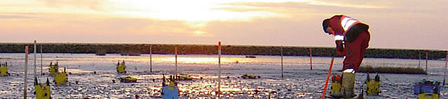
- Hydroacoustics and bathymetry for underwater subsoil exploration
In our exploration endeavours we not only rely on geophysical surveys combined with geological and geotechnical evaluations, but also utilise geodetic data for an all-round more reliable result. For example, our integrated solutions can be used to achieve better planning reliability and a smooth flow of production for your structural projects. At DMT we put together the optimum combination of exploration techniques for each individual client, placing great emphasis on finding environmentally friendly and non-destructive solutions as far as possible.
Methods
Seismology
- 2D-, 3D- high resolution reflection seismics and refraction seismics (P and S waves)
- Refraction seismics (CMP, GRM), refraction tomography
- Surface wave weismics (MASW)
- Seismic tomography in boreholes
- Hydroacoustics (marine seismics) in waters
- Vertical Seismic Profiling (VSP)
- Tunnel seismics (TRUST)
Potential method
- Gravimetry
- Magnetics
- Electrical and electromagnetic processes: Direct current geoelectrics, soundings
- Geoelectric tomography (ERT)
- Complex geoelectrics
- Induced Polarization (IP)
- Capacitive coupled geoelectrics (CCR)
- Self-potential measurements (SP)
Electromagnetic processes
Electromagnetic processes can be carried out in the frequency domain (FEM) as well as in the time domain (TDEM). DMT uses the following electrical and electromagnetic methods:
- Frequency Domain Electromagnetics (FEM)
- Time Domain Sounding (TDEM)
- metal detectors
- Magnetotellurics (MT)
- Georadar/ Ground Penetrating Radar (GPR)
Offshore processes
In the offshore sector we combine the techniques:
- Bathymetry
- Sonar measurements,
- Marine Seismology and
- Marine Electromagnetics
Borehole geophysical investigations
In order to link the measured values and results of geophysical investigations with geotechnical soil properties, exploration from boreholes or pits is required. Borehole geophysical investigations are particularly useful as they enable a direct link between geophysics and geotechnics on the spot.
- Standard Borehole Probes
- Optical and acoustic borehole scanner
- 3D cavity scanner
- 3D borehole radar
- Wireless borehole probes
- Anchor borehole probes.


Please feel free to contact our specialists.
Contact us
- Dr Boris Dombrowski
- geotechnics(at)dmt-group.LÖSCHEN.com
- Contact form

